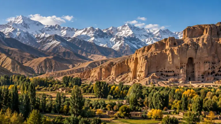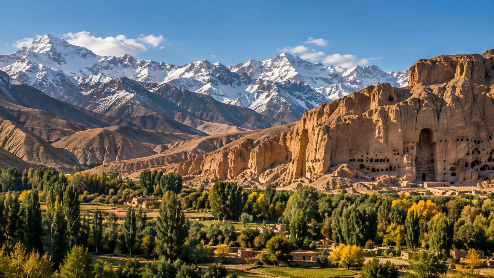
In winter the Bamiyan valley becomes a study in light and shadow. Snow covers the fields of the valley floor and the mud-brick villages, dusts the long cliff to the north, and turns the Koh-e Baba range to the south into a wall of white. This photo essay follows the valley through the cold months, scene by scene, from the empty niches in the cliff to the frozen lakes in the mountains beyond.
Bamiyan lies in a long basin in Afghanistan’s central highlands, about 50 kilometres long and at most 15 kilometres wide, between the Koh-e Sang-e Chaspan (4,400 metres), the westernmost arm of the Hindu Kush, to the north and the Koh-e Baba (5,135 metres) to the south. The basin sits between 2,500 and 3,000 metres above sea level. Its climate is continental and high-altitude, with severe winters: short-term records give a January average of about −5.6 °C against 17.4 °C in July, and only around 148 millimetres of precipitation a year.
The great cliff
The niches in winter
The long cliff that closes the valley to the north holds the niches of two giant standing Buddhas, 55 and 38 metres tall, which were destroyed in 2001. In winter the tall, empty niches stand out sharply against the pale rock and the snow on the ledges. Since 2003 the cultural landscape and archaeological remains of the Bamiyan valley have been inscribed on UNESCO’s World Heritage List.
A honeycomb of caves
Along the foothills of the cliff, numerous caves once formed a great ensemble of Buddhist monasteries, chapels and sanctuaries, dating from the 3rd to the 5th century CE. Many are linked by galleries, and some still hold remains of wall paintings and seated Buddha figures. About 3 kilometres to the southeast, in the Kakrak valley, more than a hundred further caves date from the 6th to the 13th century, among them fragments of a 10-metre standing Buddha and a sanctuary with painted decoration from the Sasanian period. Along the Fuladi valley, about 2 kilometres southwest of the cliff, the caves of Qoul-i Akram and Lalai Ghami hold decorative features of their own.
Taken together, these sites record the artistic and religious life of the region from the 1st to the 13th century. UNESCO describes them as a meeting point of Indian, Hellenistic, Roman and Sasanian influences, later joined by Islamic ones, which shaped the Gandharan school of Buddhist art.
Fields at rest
The valley floor
Below the cliff, the flat alluvial floor of the valley, known as the Tagab, is a narrow strip some 20 kilometres long and only 1 to 2 kilometres wide. In the growing season it is green with irrigated wheat, alfalfa and potatoes, apricot and apple orchards, and rows of poplars and willows. In winter the fields rest under snow, and the leafless trees draw dark lines across the white. UNESCO counts this traditional land use, together with the valley’s simple mud-brick buildings, as part of what gives the cultural landscape its value.
Water from the Baba
The valley is lopsided. The north-facing slopes of the Koh-e Baba are better watered than the Hindu Kush side, so the longer and fuller streams flow in from the south. That matters, because on the valley floor nothing grows without irrigation; dry farming is possible only on the mountainsides. The Baba range itself stays under snow for about six months of the year.
Fortresses on a white plain
Shahr-e Gholghola
In the middle of the basin, south of the great cliff, rise the remains of the fortress of Shahr-e Gholghola. Dating from the 6th to the 10th century, it marks the original settlement of Bamiyan, a stopping place on a branch of the Silk Road that linked China and India by way of ancient Bactria. After snowfall its broken walls and mounds stand out clearly against the plain.
Shahr-e Zuhak and Qallai Kaphari
Further east along the valley, the fortification walls and settlements of Qallai Kaphari date from the 6th to the 8th century. Further still, about 15 kilometres east of the cliffs, lies Shahr-e Zuhak, where early remains are overlaid by building of the 10th to the 13th century under the Ghaznavid and Ghorid dynasties.
A crossroads of passes
The old winter barrier
Bamiyan did not rise on farming but on its position. The basin is a key point on the roads and passes that link ancient Bactria with the Kabul basin and northwestern India, and its place midway between Bactria and Peshawar, at the approach to the most difficult passes, made it a natural stop where caravans found provisions and lodging. To the east, the Shibar pass (2,985 metres) gives easy access to the Ghorband valley.
The Shibar road was made fit for motor vehicles in the 1920s and remained the busiest route over the Hindu Kush until 1964, when the Salang tunnel shifted traffic to a route that could be used in winter. To the southeast, a shorter road to Kabul climbs over the Hajigak and Onay passes, at about 3,700 and 3,350 metres.
Snow as a season of play
Skis on the Koh-e Baba
Above the valley, the Koh-e Baba rises to jagged peaks of about 5,000 metres, with steep chutes and broad, rounded shoulders reaching some 4,000. Since 2011 these slopes have hosted the Afghan Ski Challenge, a backcountry race first organised by the Swiss journalist Christoph Zürcher and the local entrepreneur Gull Hussain Baizada. Eight Afghan racers took part the first year, having learned to ski only weeks before.
The Challenge season runs from February into March. A ski school opened in February 2012 and trained about 60 young people at first, girls have raced since the very beginning, and skiing has turned winter, once a slack season, into a time of work for local guides, drivers and guesthouse staff. By 2017 Bamiyan had five local ski clubs with more than 200 members between them, and in 2016 the Afghanistan Ski Federation became a member of the International Ski Federation.
Band-e Amir in ice
About 75 kilometres to the northwest, near Yakawlang, the six lakes of Band-e Amir lie at about 2,900 metres behind natural dams of travertine. Declared Afghanistan’s first national park in 2009, they are a summer destination: in winter temperatures can fall to −20 °C and the lakes freeze over, waiting, like the fields of Bamiyan, for spring.